
Strangest Maps Ever Created – You Have Never Seen Our World Like This!
Ellen Lloyd - AncientPages.com - In ancient times people saw the world in a very different way. This collection of maps must be one of the strangest representations of world depictions ever created.
Some of these maps are fantasy. As you can see, the shape of the countries and continents are odd representations of figures or animals. Other maps depict what our ancestors believed to be Biblical Lands.
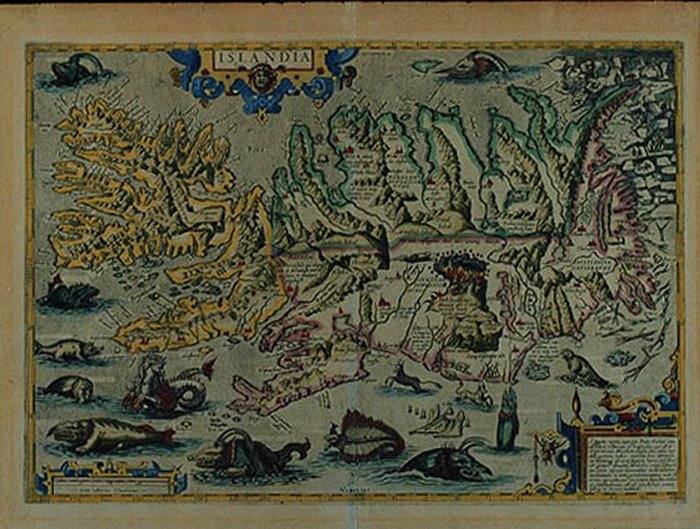
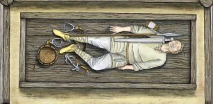
Islandia. From the Theatrum Orbis Terrarum of Abraham Ortelius. Antwerp, c. 1585. Image credit: Yale University
"Legends of strange human beings have a long history, as do their depictions on maps. Many of these representations were derived from the descriptions given in the Natural History of the World by the elder Pliny (AD 23-79) and first printed in Latin in 1469. Pliny's ideas were absorbed by most geographers of the 16th century and were particularly well illustrated in the successive editions of Ptolemy's maps published by Sebastian Munster from 1540 onwards. On the Ptolemaic map of Asia, a number of strange beings are placed in Scythia or part of Northern Asia.
At the top of the map, Munster shows the Anthropophagi, who feed on men's flesh and live near the North Pole.
In the margins he depicts those humans described by Pliny in Book 7:
"In India, there is a kind of men with heads like dogs...who in lieu of speech use to bark. Likewise, there is a kind of people named monoscelli that have but one leg apiece. In the hottest season of Summer, they lie along their back and defend themselves with their foot against the Sunnes heat."

Asia Secunda Pars Terrae in Forma Pegasir. Die Gantze Welt in ein Kleberblat. Heinrich Bunting, c. 1590. Image credit: Yale University
The last tribe showed, those with their faces below their shoulders, later reappear, as do the anthropophagi, in the New World of America, as legends of the Old World were transferred to the unexplored continent. Sir Walter Raleigh, in his description of Guiana, tells of the existence of a warrior tribe with their heads below their shoulders in the Orinoco basin and also describes the fierce Amazonian women."
Then of course we have the legendary Garden of Eden. For over 1500 years the existence of the Garden of Eden was an unquestionable fact for most Christian believers. Its location varied, but in the early Middle Ages, it was generally thought to be at the eastern extremity of the world, while later it was placed in the area of Mesopotamia.
Early mapmakers often recorded on their maps and charts the presence of fabulous beasts, many of which reveal themselves as identifiable species made grotesque by the embroidered tales of sailors and travelers. Of the many maps depicting sea monsters, the Carta Marina by Olaus Magnus was the most influential. First printed in 1539, it showed the area of the North Sea filled with dangerous maritime creatures. Sea monsters depicted and described by 16th-century ecclesiastic, cartographer, and historian Olaus Magnus were popular until the mid-18th century.
Ortelius copied many of these monsters for his map of Iceland, published in editions of his Theatrum Orbis Terrarum. Iceland is shown at a large scale, with its fjords, glaciers, and mountains, including an erupting volcano, Mt. Hekla. Polar bears on icebergs can be seen at the top right, while the ocean contains probably the most fantastic collection of sea monsters to be seen on one engraving.
Among the earliest cartographic oddities are the famous maps from Heinrick Bunting's Itinerarium Sacra Scripturae, or Travels According to the Scriptures, first published in 1581.
A description of Biblical lands, it was a popular book that was reprinted many times. In addition to correct maps of the Holy Land, it also contained three maps of pure fantasy: the world in the form of a cloverleaf, Europe as a robed female figure, and Asia as Pegasus the mythical winged horse.
The horse is drawn fairly realistically so that the shape of Asia has to be adjusted; the Caspian Sea lies horizontally between the wings and the saddle, and modern India is the off hind leg. The Pegasus map can be found in a number of different editions in both woodcuts (as displayed here) and more rare copperplate versions.
In Bunting's map of the world as a cloverleaf, representing the Trinity, each of the three continents of the Old World forms a section, with Jerusalem in a circle in the center. England and Scandinavia appear separately at the northern edge of the map, and the new continent of America can be seen in the lower-left corner.
It has been suggested that the cloverleaf design represents not only the Trinity but the arms of Bunting's native city of Hanover.
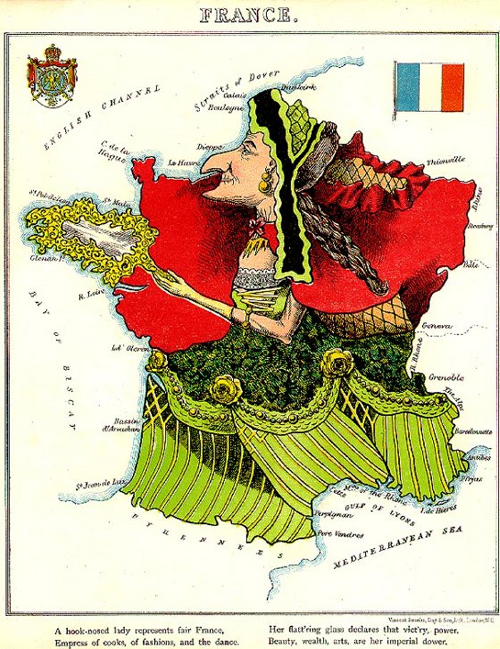
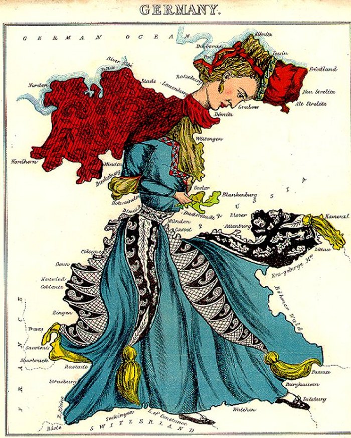
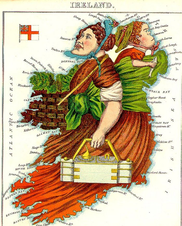
These maps are from Geographical Fun, or Humorous Outlines of Various Countries, published by Hodder and Stoughton in 1869. The author, William Harvey writing under the pseudonym Aleph, created a series of twelve maps showing various countries as curious people in the great tradition of English caricaturists. The idea behind the maps was taken from sketches drawn by a fifteen-year-old girl wishing to amuse her sick brother confined to bed.

Harvey states in the introduction: "It is believed that illustrations of Geography may be rendered educational, and proof of service to young scholars who commonly think Globes and Maps but wearisome aids to knowledge." The maps and rhymes were thus designed to amuse children and to teach some basic geographical concepts, rather than as political satires.
These maps are part of the Yale University Map Collection.
Written by: Ellen Lloyd - AncientPages.com
Copyright © AncientPages.com All rights reserved. This material may not be published, broadcast, rewritten or redistributed in whole or part without the express written permission of AncientPages.com
More From Ancient Pages
-
 Dwarka – Pre-Harappan City That Could Rewrite The History Of The World
-
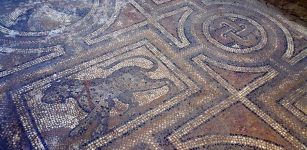 Ruins Of A Roman-Era Bath And A Floor Mosaic Discovered In Central Anatolia
-
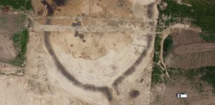 Mysterious 7,000-Year-Old Circular Structure Near Prague Investigated By Scientists
-
 Ancient Secrets Of Mistletoe – Sacred Celtic Plant With Magical Powers
-
 Cenomani People: Their Pre-Roman Celtic Cemetery Reveals Funerary Customs
-
 Vindolanda Wooden Tablets: Ancient Military And Private Correspondence Left By Departing Roman Troops
-
 3.2 Million-Year-Old ‘Lucy’ Could Walk On Two Legs – First Hominin Muscle Reconstruction
-
 Monster Water God Gong Gong Blamed For Cosmic Catastrophes In Chinese Myths
-
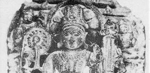
 Ancient Nandivardhan Was The City Of Vakataka Rulers Who Built Ajanta Caves
-
 Mystery Of 3,000-Year-Old Conical Hats – Was It A Highly Advanced Device?
-
 LIDAR Discovers Lost Ancient Cities Older Than Any Known Complex Amazonian Society
-
 Legend Of The Loretto Chapel Staircase – Unusual Helix-Shaped Spiral Construction
-
 Magnificent Chamber Graves Of Four Scandinavian Warriors Discovered In Poland – The Piast Dynasty In New Light
-
 Ancient People In Tasmania Witnessed Stunning Auroras When The Earth’s Magnetic Field Flipped
-
 Hathor – One Of Ancient Egypt’s Greatest Female Deities
-
 Hidden Manuscripts Reveal Ancient Sacred Wisdom Of The Gods And Surprises
-
 Yam: Tyrannical Hydra-Like Sea Monster God Cast Out Of Heaven
-
 Controversial Theory Suggests Ancient Egyptians Were Founders Of Chinese Civilization
-
 Ancient People Handled Sun Exposure Better Than Modern People – An Anthropologist Explains Why
-
 Keshwa Chaca – Last Suspension Rope Bridge Of Inca People