
Imago Mundi: Famous Babylonian World Map Is The Earliest Known In The World
A. Sutherland - AncientPages.com - This cuneiform ancient map of the Babylonian world is an archaeological treasure equal to the Rosetta Stone and the code of Hammurabi. It probably originates from Sippar, southern Iraq.
The Babylonian World Map, also known as Imago Mundi is usually dated to the 6th - 7th century BC. It is one of the oldest known world maps (if not the oldest) and certainly the most famous one.

A close-up view of the Babylonian map of the World. This partially broken clay tablet contains both cuneiform inscriptions and a unique map of the Mesopotamian world. Probably from Sippar, Mesopotamia, Iraq. 700-500 BCE. The British Museum, London.
According to the Babylonian view, this map represents the entire world known to them.
The tablet contains both a cuneiform inscription and a unique map of the Mesopotamian world at the time of Sargon (2300 BC) as a circle surrounded by water, with Babylon at its center.
The inscription indicates that it was a copy of a previous map and the locations featured on the map indicate that the original could not have been created earlier than the 9th century BC. The majority of the Babylonian Map of the World is preserved.
The earth is depicted with two concentric circles, one inside the other. The inner circle, the earth, contains eight small circles, most of which are labeled, which represent cities.
Babylon is shown in the center (the rectangle in the top half of the circle), and Assyria, Elam and other places are also named. The central area is ringed by a circular waterway labeled 'Salt-Sea'.
The outer rim of the sea is surrounded by what were probably originally eight regions, each indicated by a triangle, labeled 'Region' or 'Island', and marked with the distance in between.

The Babylonian Map of the World with translations. © Trustees of the British Museum. (After Reade, 2008). Image via Avary Taylor, Marian Feldman/Rice University
The cuneiform text describes these regions, and it seems that strange and mythical beasts, as well as great heroes, lived there, although the text is far from complete.
The regions are shown as triangles since that was how it was visualized that they first would look when approached by water.
On the map, “Assyria” (perhaps the Assyrian city Nineveh), “Der,” and “Susa,” the Elamite capital, are labeled. Two other circles are simply labeled “city” (Akkadian URU) and three circles show a central dot but are unlabeled. These unlabeled circles are perhaps representations of the “ruined cities” (ālānu abtūtu) mentioned in the text on the obverse. Babylon, rather than being represented as a circle, is rectangular with an encased dot.
Three geographic areas are labeled but not enclosed within a shape:
1) Urartu, a kingdom located in the plateau between Anatolia, Mesopotamia, Iran, and the Caucasus Mountains;
2) Habban, a Kassite tribal area in western Iran; and
3) Bit Yakin, the territory of an Aramaean tribal group located on the southern Euphrates. Topographical features include the unlabeled Euphrates River, which bisected Babylon in the first millennium BCE, a “mountain” (šadû), a “swamp” (apparu), and a “channel” (bitqu). The placement of the Euphrates, which is shown running from the “mountain” down to the “swamp,” seems to indicate that the mountain should be identified as those in southeastern Turkey, the source of the Euphrates, while the “swamp” would depict the marshlands along the southern Euphrates that existed in antiquity.
The channel, then, may be identified as an ancient waterway used to bypass the marshes and enter the Persian Gulf. The outer circle of the Map of the World is labeled “salt-sea” (Akkadian marratu). Four triangular “regions” (nagû) extend out from the ocean, although there were probably eight in total, the remaining three not being preserved on the fragmented tablet. Of the four semi-preserved nagû, only one has a description beyond lengths of distance, naming it “Great Wall, where the Sun is not seen.” (
The map is sometimes taken as a serious example of ancient geography, but although the places are shown in their approximately correct positions, the real purpose of the map is to explain the Babylonian view of the mythological world.
Written by – A. Sutherland - AncientPages.com Senior Staff Writer
Copyright © AncientPages.com All rights reserved. This material may not be published, broadcast, rewritten or redistributed in whole or part without the express written permission of AncientPages.com
Expand for referencesMore From Ancient Pages
-
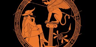 Oedipus – Tragic Prophecy About A Man Who Couldn’t Escape Fate
-
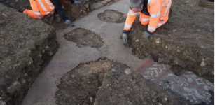 Stunning Colorful Ancient Roman Mosaic With Found Under Aldi Supermarket Site In UK
-
 Why Didn’t Pythagoras And His Followers Eat Beans?
-
 Mysterious Viking Gerdrup Grave – Burial Place Of Sorceress Katla And Her Son Odd Mentioned In The Eyrbyggja Saga?
-
 Magnificent Etruscan Underground Burial With Beautiful Artifacts Discovered In Aleria-Lamajone, France
-
 Rare Unexpected Discovery Of Elizabethan-Era Ship At Quarry 300 Meters From The Coast
-
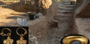
 Hundreds Of Highly Unusual Burial Gifts Found In Special Viking Chamber Belonging To Woman In Norway
-
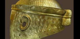 Helmet Of Meskalamdug – Sumerian King Of The First Dynasty Of Ur
-
 The Legend Of Little Deer—Interesting Cherokee Tale Of How Disease And Medicine Began, And Why The Native Americans Respect All Life
-
 Tracing Footsteps Of Giants In Africa – Obscure Past Of Mzoura Stones
-
 Zoroaster’s Doomsday Prophecy About Comet Gochihr And Its Similarity With The Apocalypse Of John In The Book Of Revelation
-
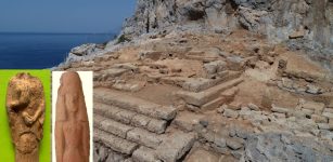 Secrets Of The Ancient Temple Of Dimitra At The Acropolis Of Falasarna Revealed By Archaeologists
-
 Two 1,800-Year-Old Sarcophagi Of Wealthy People Accidentally Found At Ramat Gan Safari Park
-
 Pytheas’s Voyage To The Arctic In 325 B.C. And Account Of Thule, The Strange Land Beyond
-
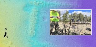 LIDAR Will ‘Map’ The Ground Surface To Reveal New Picture Of Ancient Native American Culture
-
 Clapping To Show Appreciation Is An Ancient And Widespread Behavior
-
 Previous Studies Of European Genetic Ancestry May Be Inaccurate – Re-Evaluation Is Needed
-
 Rare Bronze Age Sacrificial Offerings, Including A Bent Sword Found In A Bog Near Veksø, Denmark
-
 What Can Archaeology Tells Us About Climate Change?
-
 On This Day In History: Battle of Champion Hill Was Crucial Action Of Grant’s Vicksburg Campaign – On May 16, 1863