Did Roman Fortifications On Eastern Frontier Function As A Wall Or A Road?
Conny Waters - AncientPages.com - During a pioneering aerial survey of the Near East in the 1920s, the Jesuit French priest Father Antoine Poidebard undertook one of the world's first aerial archaeological surveys.
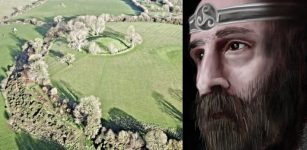
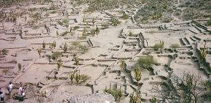
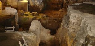
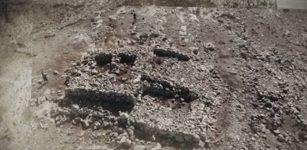
A sample of Poidebard's (Reference Poidebard1934) aerial photographs: A) fort at Qreiye; B) Roman fort and medieval caravanserai at Birke; C) fort at Tell Zenbil; and D) castellum at Tell Brak.
Using a biplane and a camera, Poidebard recorded hundreds of ancient forts and other sites throughout what today is Syria, Iraq, and Jordan. These places formed the eastern frontier of the Roman Empire and played a vital role as the line of defense against incursions from the east.
Today, known mainly for using aerial photography as an archaeological survey tool, Poidebard also contributed much more.
He mapped previously unknown Roman-period forts and defensive installations over an area that stretches more than 1000km along the eastern border of the empire.
Castellum at Tell Brak: A) CORONA (1102, 17 December 1967); B) CORONA (1105, 4 November 1968); C) HEXAGON (1204, 17 November 1974); and D) modern satellite imagery (© ESRI and Maxar Technologies) (figure by authors; CORONA and HEXAGON imagery courtesy US Geological Survey).
Using declassified images from the CORONA and HEXAGON spy satellite programs, the team identified a further 396 previously undocumented forts or fort-like buildings, compared with the 116 forts recorded by Poidebard.
Our study has successfully identified 396 archaeological features that exhibit a remarkable similarity to the original forts documented by Poidebard.
Further, the authors of the paper write that “the spatial distribution of the forts we have mapped no longer supports Poidebard's central thesis that they constituted a broadly north-south line along the eastern boundary of the empire.”
Instead, the forts form a roughly east-west line following the margins of the inland desert, connecting Mosul on the Tigris River in the east with Aleppo in western Syria.
The team also suggests that the structures significantly contributed to transporting individuals and commodities across the Syrian steppe.
In his aerial survey, Poidebard focused on evidence of Roman-period fortifications along the eastern frontier of the empire. He investigated “a route stretching from Borsa on the Jordanian border, north through Palmyra and Raqqa, south-east along the Euphrates River to its confluence with the Khabur, then north again to Nisibis on the modern-day Turkish border, ending at the Tigris River,” the team’s paper states.
During the reigns of Septimius Severus (AD 145–211) and Diocletian (AD 284–305), the Roman invested much money in military and transport infrastructure along its eastern border.
CORONA images showing major sites: A) Sura (NASA1401); B) Resafa (NASA1398); and C) Ain Sinu (CRN999) (figure by authors; CORONA imagery courtesy US Geological Survey).
Poidebard recorded hundreds of fortified military buildings, including some of the best-known Roman forts in the region. He argued that the forts were mostly constructed during the second and third centuries AD, and functioned as a wall to fortify the eastern Roman provinces and protect against incursions by Arab nomads or Persian armies.
Limited Number Of Fortifications Were Investigated
Many scholars have argued that the forts could not have functioned as a wall because they were located too far apart from one another to prevent passage into the province. Instead, the forts guarded strategic oases, presumably to provide protection for the movement of military and commercial caravans.
Sample of small forts recorded by Poidebard: A) Cholle (CRN5958); B) CRN2657; C) CRN2545; D) Tell Seyh Hamed (CRN774); E) CRN2857. Newly documented small forts: F) CRN2947; G) CRN2967; H) CRN10098; I) CRN2593; J) CRN10050; K) CRN10092; L) CRN10095 (figure by authors; CORONA imagery courtesy US Geological Survey).
Yet another possibility is that the forts functioned primarily to defend sedentary populations against raids by nomadic groups, who regularly moved throughout the region.
While historians have shown a sustained interest in the fortifications, the archaeological research conducted on them has been relatively limited.
Using corrected CORONA imagery, the team focused their work on a 300 000km2 region extending from western Syria to northern Iraq, we first mapped all previously published archaeological sites in this study area, creating a database of approximately 4500 sites.
The task of mapping all the forts initially documented by Poidebard proved to be challenging due to the extensive damage inflicted on numerous sites.
This was a result of increased land utilization in the subsequent years. Furthermore, several of these sites were entirely missing from satellite imagery captured in the 1960s.
“Thus, on the CORONA imagery, we were only able confidently to identify extant architectural remains at 38 of Poidebard's 116 forts,” according to the researchers.
The newly discovered forts documented here are most frequently square fortifications measuring 50–80m per side, but we have also found numerous larger, more complex fortresses comprised of multiple buildings and larger enclosure walls up to 200m per side.
The study also suggests widespread abandonment of forts by the sixth century AD, although many of the larger fortifications have long histories of later occupation into the medieval period.
Conclusions: A Wall Or A Road?
This research has presented the results of a remote sensing-based research project that has mapped and described 396 previously unidentified forts or fort-like archaeological sites throughout the desert margins of eastern Syria and north-western Iraq.
Poidebard's dating of the forts, based on excavations at the castellum at Tell Brak and soundings at several other sites, appears to be largely confirmed by more recent excavations in eastern Syria, northern Iraq and eastern Jordan. Poidebard initially documented 116 forts, which he argued had mostly been constructed during the second or third century AD.
Also the authors of this study argue that "most—but certainly not all—of the fort sites documented in this study are likely to be Roman and late Roman in date.
There is also substantial evidence indicating that by the sixth century AD, many forts had been largely deserted. However, it's noteworthy that numerous larger fortifications continued to be occupied well into the medieval era, thus demonstrating their long-standing historical significance.
The distribution of these forts suggests that they did not function as a border wall, with a series of towers and fortified encampments designed to block westward incursions by Persian armies or to prevent raids on agricultural villages by nomadic tribes.
Instead, the recent findings strengthen an alternative hypothesis that these forts supported a system of caravan-based interregional trade, communication and military transport.
Written by Conny Waters - AncientPages.com Staff Writer


