
Why Did A Solar Eclipse Save George Davidson’s Life In Alaska?
Conny Waters - AncientPages.com - Scientific curiosity and searching for knowledge can sometimes be dangerous. This is a lesson American astronomer and geographer George Davidson learned when he traveled with his research team to Klukwan, near Haines in southeast Alaska, in 1869.
Ancient people have always been fascinated with solar eclipses, but the understanding of this natural phenomenon has varied among civilizations.
Famous Greek philosopher and scientist Thales of Miletus (625 BC - 545 BC), who was recognized as one of the seven sages of ancient Greece, was a brilliant astronomer who predicted an eclipse of the sun that occurred on 28 May 585 B.C.

George Davidson (1825 - 1911). Credit: Public Domain
Ancient civilizations found astronomical phenomena fascinating, and many studied the Sun, Moon, and other celestial objects regularly. Solar eclipses are often used as fixed point-to-date events in the ancient world. Using a combination of a Biblical text and an ancient Egyptian text, scientists have been able to pinpoint the date when world’s oldest solar eclipse took place.
The event, which occurred on 30 October 1207 BC, is mentioned in the Bible and could have consequences for the chronology of the ancient world.
Ancient people studied solar eclipses regularly. Our ancestors were so impressed that some ancient solar eclipses re-wrote history. There were also moments when the darkness of the skies was seen as an omen or sign from God. Some ancient solar eclipses have stayed in people's memory for generations.
Some civilizations found solar eclipses very frightening, and this fact saved George Davidson's life.
Davidson visited Alaska primarily to observe a total solar eclipse occurring on August 7, 1869. He made his headquarters at an Indian village thirty miles from the mouth of the Chilkat River.
Davidson and his team selected this particular place because they knew it would be particularly clear to observe the upcoming solar eclipse.
However, a Native American tribe in the valley spotted the scientists, and the suspicious locals became angry and threatening.
When Davidson explained that a solar eclipse would occur the following day, the Indians temporarily left them alone.
When the eclipse really happened, the Indians fled, and the sudden darkness saved the scientists' lives. Later, the Indians returned, and they were very impressed with Davidson’s knowledge of the event they had witnessed. The solar eclipse led to a remarkable intellectual potlatch, an ancient North American Indian tradition of ceremonial exchange of gifts.
“In the days afterwards, Davidson made a painting on a cedar plank of the sun and its corona, as he had seen it at totality in his specially prepared telescope.”
In exchange, Kohklux and his wives made a large map for Davidson, presenting the complex geography of the main ancient trade routes used by the Chilkat Tlingit. 1
“At his own suggestion Kohklux proposed to draw upon paper his route,” Davidson later noted. “Kohklux started from his place at Klukwan and drew all around the paper and I gave him the back of an old map on which he and his wife drew their routes etc. in 1852.”

A lithograph of the sun and solar corona, as observed by George Davidson at Klukwan, August 8, 1869, appeared in the Coast Survey annual report for 1869.
The chief detailed the long-established trading route up the Chilkat River, over the pass, and through the Southern Tutchone trading centers of Neskatahin, Hutshi, and Aishihik en route to the Yukon River. The Chilkat Tlingit had long maintained strict control over the trade in furs between the interior and the coast. Acting as powerful middle marketers, the Tlingit mediated trade relations between Russian and later Hudson's Bay Company and American maritime merchants. The route that Glave and his party“pioneered” had a long and well-trodden history.
“Lying face downward the old chief and his wife discussed and laboriously drew on the back of an old chart the lines of all the water courses, and lakes with the profile of the mountains as they appear on either hand from the trail… and the limit of each of the fourteen days journey across to Fort Selkirk is marked by cross-lines on this original Chilkat map,” as a National Geographic magazine writer, Eliza Scidmore, explained this episode of indigenous mapmaking. So accurate was the map, according to Scid- more, that “this Kloh-Kutz map was the basis of the first charts.
”But the map was not only a relatively accurate representation of the topographical features of this critical trade route; the map was also a memory.” 2
Written by Conny Waters – AncientPages.com Staff Writer
First version of this article was published on April 3, 2020
Copyright © AncientPages.com All rights reserved. This material may not be published, broadcast, rewritten or redistributed in whole or part without the express written permission of AncientPages.com
Expand for references
More From Ancient Pages
-
 Unsolved Old Cherokee Mystery In The Great Smoky Mountains
-
 Mysterious And Unexplained Encounter With Unusual Tiny Beings In Italy – The Thing – Part 1
-
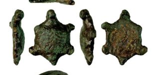 Roman Copper-Alloy Tortoise Figurine Discovered In Suffolk, UK
-
 Rare Discovery Of 4,300-Year-Old Copper Ingots Left By Mistake In A Settlement In Oman
-
 Drought Reveals 2,000-Year-Old Rock Carvings In Brazil’s Amazon
-
 Extraordinary Fossils From The End Of The Age Of The Dinosaurs – Study
-
 Why Was The Moretta Mask So Popular?
-
 Mystery Of The Horrible ‘Thing’ Found In A Dominican Monastery
-
 A 2,700-Year-Old Urartians’ Ayanis Castle And Haldi Temple – Soon An Open-Air Museum
-
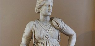 Goddess Artemis – One Of The Most Respected Olympians
-
 Magnificent Ancient Treasures Of The Mysterious Kangju Kingdom Found By Archaeologists
-
 Silla: The Most Successful Of Three Korean Kingdoms
-
 Merovingian Dynasty Of Long Haired Kings
-
 Aztecs’ Five Suns Creation Myth And Prophecy
-
 Teens Make Incredible Discovery In An Ancient Florida Cave
-
 Sinuses Prevented Prehistoric Crocodile Relatives From Deep Diving
-
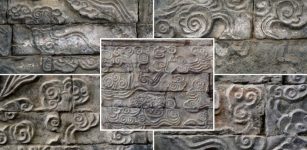 Huge Over 1,000-Year-Old Beautiful Stone Murals Discovered In Central China
-
 Ancient Roman Port Discovered Off The Syrian Coast
-
 On This Day In History: Treaty of York Was Signed – On Sep 25, 1237
-
 Ancient Chinese Version Of Quipu -Tradition Of Tying Knots Dates Back To Antiquity