
LIDAR Discovers Lost Colonial City Hidden In The Amazon Rainforest
Jan Bartek - AncientPages.com - LIDAR technology continues to prove its value in revealing what lies beneath dense vegetation. Recently, archaeologists have increasingly turned to LiDAR (Light Detection and Ranging) to locate ancient structures that are not easily visible from the ground, yielding remarkable results.

Credit: Adobe Stock - prasitphoto
The Brazilian Socio-Environmental Institute has now announced the discovery of a lost colonial city in the Amazon forest, unveiled at an event by the Amazon Museum in Manaus as part of the Amazônia Revelada project.
This city, dating back to the 18th century, was a Portuguese settlement known from historical maps but whose precise location remained elusive until now. Eduardo Neves, director of the Museum of Archaeology and Ethnography at the University of São Paulo and leader of this research effort, confirmed its discovery in the Upano Valley at least 250 years old.
The city had been concealed for centuries by dense vegetation, offering new insights into Amazonian history. According to the Brazilian news outlet Metrópoles, Neves explained that it had been abandoned; nature had reclaimed it, and stone blocks had been removed.
“This is older than any other site we know of in the Amazon.
We have a Eurocentric view of civilization, but this shows we have to change our idea about what is culture and civilization,” Professor Stephen Rostain, director of investigation at the National Centre for Scientific Research said.
The Amazônia Revelada project combines cutting-edge archaeological research with the traditional knowledge of forest peoples. It aims to enhance Amazon protection and help curb forest destruction. The project seeks to identify archaeological sites throughout the Amazon using two complementary strategies. The first involves flyovers using LIDAR technology to detect potential archaeological sites beneath the forest. In the Amazon, significant landscape transformations and urbanization have occurred through large-scale soil movement, as seen in the geoglyphs of Acre. The goal is to use LIDAR in areas that, unlike eastern Acre, remain forested.
The second strategy involves surveys by local researchers, members of the indigenous and traditional communities, who will document material elements or inscriptions in the landscape reflecting the biocultural heritage of these areas. These researchers will record archaeological sites or places significant to the communities. The project aims to showcase the temporal and material diversity of the Amazon's archaeological record, which has been evolving for at least 12,000 years and continues to be shaped by the Peoples of the Forest.
The scientists intend to highlight the connections between these communities, their territories, and the cultural heritage within them.
The Amazon region has a rich history of human habitation, dating back at least 11,000 to 12,000 years. However, some artifacts suggest the possibility of even earlier settlement, potentially extending the timeline to over 13,000 years ago. Indigenous peoples in this area developed complex societies well before European contact.
There is evidence of large and settled communities that practiced agriculture and employed advanced land management techniques. LIDAR technology has played a crucial role in uncovering hidden archaeological sites within the Amazon, providing valuable insights into its historical landscape.
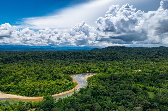
Ecuador Amazon Rainforest. Credit. Adobe Stock - Curioso.Photography
As Ancient Pages reported earlier this year, while mapping sites in the Ecuadorian Amazon, scientists detected a dense network of interconnected cities, now hidden beneath the forest in Ecuador’s Upano Valley. According to a study published in the journal Science, the settlements are at least 2,500 years old, more than 1,000 years older than any other known complex Amazonian society.
The results of LIDAR data offer evidence that this ancient Amazonian settlement, tucked into the forested foothills of the Andes, was once home to 10,000 farmers. It has even been suggested the settlements were home to as many as 15,000 or 30,000 at its peak, said archaeologist Antoine Dorison, a study co-author at the same French institute. The number is comparable to the estimated population of Roman-era London, then Britain's largest city.
See also: More Archaeology News
The recent breakthrough by the Amazônia Revelada project highlights that the dense forest still holds countless secrets waiting to be uncovered. To aid archaeologists and scientists in this exciting endeavor, LIDAR stands out as an indispensable tool. Its precision and capability to penetrate thick vegetation make it an unparalleled asset in revealing the hidden wonders of the Amazon. Embracing LIDAR technology will undoubtedly increase our understanding of this rich ecosystem to new heights.
Written by Jan Bartek - AncientPages.com Staff Writer
More From Ancient Pages
-
 On This Day In History: Battle Of Sinop Took Place – On Nov 30, 1853
-
 Lost Golden City Of Pharaoh Amenhotep III Discovered In Luxor
-
 On This Day In History: Samurai Final Battle of Shiroyama Was Fought – On Sep 24, 1877
-
 Incredible Anatomical Human Machines – Two Fleshless Bodies Mystery
-
 Controversial Roman Emperor Heliogabalus Wanted To Be A Woman And Much More
-
 Jesus Christ’s Tomb Dates To Roman Emperor Constantine’s Era – Researchers Confirm
-
 Controversial 5,500-Year-Old Sumerian Star Map Of Ancient Nineveh Reveals Observation Of Köfels’ Impact Event
-
 Yomi – Kingdom Of The Dead In Japan’s Native Shinto Religion
-
 7th Century Inscription Found On Stone At Tintagel Castle In Cornwall, UK
-
 Famous Viking Warrior Eric “Bloodaxe” Haraldsson: King Of Norway
-
 Evidence Of The Moon-Eyed People – More Clues – Part 2
-
 Discovery Of Second Viking Site Point Rosee In North America Could Re-Write Ancient History
-
 World’s Oldest Lunisolar Calendar May Have Been Discovered At Göbekli Tepe, Turkey
-
 Did Lead Pollution Cause IQ Declines Among Ancient Romans?
-
 Encounter Between Neanderthals And Homo Sapiens – Genome Study Traces The History
-
 Ancient City Of Metropolis: Ruins With Traces Of The Hittites, Hellenistic, Roman, Byzantine And Ottoman Empires
-
 First Fossils Of Ancient Human Relatives Sent To Space – Tribute To Science And Our Ancient History
-
 Crusader-Era Sword Discovered At Previously Unknown Burial Site In Finland
-
 Mystery Of The 1,700-Year-Old ‘Salt’ Mummy With Long White Hair
-
 People Of Old Dongola Recycled And Dyed Clothes