More Than 1, 300 Prehistoric Burial Mounds In Western Azerbaijan Have Been Systematically Surveyed For The First Time
Conny Waters - AncientPages.com - Spanning more than 1,000 kilometers in length and up to 5,600 meters in height, the mountain ranges of the Caucasus stretch between the Black and Caspian Seas.
Map of the southern Caucasus with indication of the location of the investigated region. Image source
What appears to be a huge natural barrier was actually an important contact and exchange zone between the highlands of West Asia and the Southeast European steppes for thousands of years.
Despite its importance, archaeological data from the Caucasus and neighboring regions remains fragmentary.
Researchers from the ROOTS Cluster of Excellence at Kiel University together with colleagues from the Academy of Sciences of Azerbaijan systematically surveyed and documented more than 1,300 archaeological sites in Azerbaijan in two field campaigns in 2021 and 2023.
They have now published the results of their latest research campaign in the international journal Antiquity. The article is a follow-up of an overview of the results of the 2021 field campaign, which was published in the journal Archaeological Prospection earlier this year.
A combination of different methods for the investigations
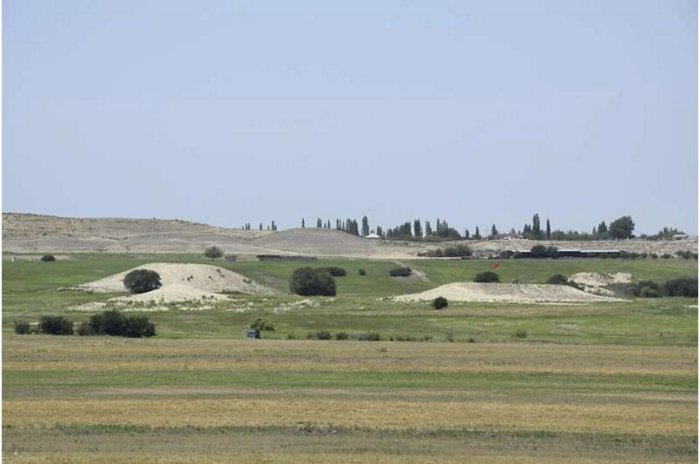
The research of the ROOTS team focuses on two areas in the administrative district of Goranboy in Western Azerbaijan, along the margins of the piedmont of the Lesser Caucasus. Burial mounds, known as kurgans, are a typical landscape feature of the region. However, there has been a lack of systematic documentation of the archaeological sites to date.
"We can only draw conclusions about socio-cultural developments in the past if we have precise data on the number, type, size, distribution and age of burial mounds and other archaeological sites," says Andrea Ricci, archaeologist and head of the project within the ROOTS Cluster of Excellence.
During the two field campaigns, the team used a combination of different methods for the investigations, ranging from remote sensing to on-site geophysical measurements.
Satellite images helped the researchers to gain an overview, analyze landscape structures and identify potential archaeological features. Comparing very early satellite images from the 1960s and 1970s with current images also revealed modern changes to the landscape. "Prior to the fieldwork, the analysis of these images confirmed the presence of a considerable number of mounds, which are probably kurgans."
On site, geological and geomorphological investigations were carried out and archaeological features were documented. Where available, the team members collected artifacts on the surface in order to date the sites.
Using a camera attached to a kite, the team also photographed selected areas covering several hectares in order to create 3D landscape models from the acquired images. "These integrated methods allow us to document the dimensions and spatial relationships of the kurgans with an intensity and precision never reached before, revealing that kurgans were often arranged in clusters," explains Dr. Bakhtiyar Jalilov, archaeologist from the National Academy of Azerbaijan (Baku) and cooperation partner of the project.
Geomagnetic and electromagnetic measurements and the use of ground-penetrating radar expanded the investigations on the Earth's surface into the ground to document the shape and size of specific kurgans.
On the Uzun-Rama plateau alone, the team was able to identify more than 1,200 kurgans. Of these, only about 200 were previously known. Another 85 kurgans were added along the Qaraçay River Valley. They date from the 4th to 1st millennium BCE. The detailed investigations revealed different structures over the millennia.
In addition to the kurgans, the team identified burial sites or individual graves from the Late Bronze Age/Early Iron Age, as well as sites dating to the Chalcolithic (5th–4th millennium BCE) and the Middle Ages (10th–15th century CE).
"With these extensive new data sets, we can now better analyze the burial culture of the region and the reciprocal relationship between humans and the environment of the South Caucasus over the past 6,000 years. In addition, these data sets can also help to better preserve these cultural traces that are so typical of the Southern Caucasus. After all, you can only protect what you know," says Ricci.
Written by Conny Waters - AncientPages.com Staff Writer


