LIDAR Discovers 18-Kilometer (11-Mile) Maya Road In The Yucatan Jungle
Conny Waters - AncientPages.com - While scanning the Yucatan jungle in Mexico with lasers, scientists from Mexico’s National Institute of Anthropology and History (INAH) discovered an 18-kilometer (11-mile) long Maya road. The sacbé (white road, in the Mayan language) linked the cities of Uxmal and Kabah over 1,200 years ago.
LIDAR helps scientists to detect ancient ruins hidden in the jungle. Credit: Adobe Stock - THP Creative
LIDAR, Light Detection and Ranging, a remote sensing technology, has once again proven it can uncover amazing ancient structures that cannot be easily detected from the ground.
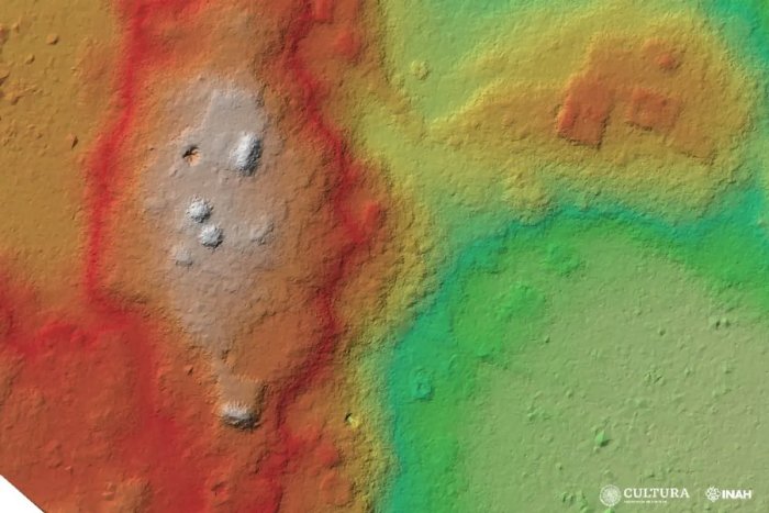
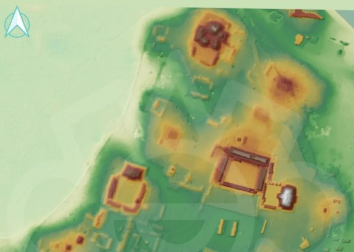
The research team scanned about 190 hectares (470 acres) of the Puuc region and picked up what appeared to be an ancient structure hidden in the jungle. Closer investigation revealed the drone had located an ancient sacbé.
The Maya road is 18 kilometers long and has a width that ranges between five and six meters. It is the largest sacbé in the northern Mayan lands, INAH scientists said in a press release. It linked the cities of Uxmal and Kabah for over 250 years between 700 and 950 A.D.
The red parallel lines show the traces of the ancient road. Credit: Uxmal Archaeological Zone
The Pre-Columbian city of Uxmal is famous for its intriguing Mesoamerican step pyramid known as the Pyramid of the Magician. It is the tallest and most visible structure in the ancient city of Uxmal. The pyramid is also known under different names, such as the Pyramid of the Dwarf, Casa el Adivino, and the Pyramid of the Soothsayer. As previously written on Ancient Pages, "in ancient times, Uxmal was one of the largest cities on the Yucatán Peninsula. Uxmal was home to about 25,000 Maya at its height, and we find the Pyramid of the Magician at the city's center."
Kabah, one of the few Maya settlements in the regions that has retained its original name (meaning 'the strong hand'), is the second largest ruin of the Puuc region after Uxmal.
The road linked the cities of cities of Uxmal and Kabah. Credit: Uxmal Archaeological Zone
Scientists do not have much information about the discovered sacbé, but it is well known that the ancient Mayans planned and built a large network of roads connecting thousands of people in the Puuc region. In 2020, a similar road was discovered between Cobá and Yaxuná.
There are still so many fascinating ancient Maya ruins hidden in the jungle that LIDAR can help archaeologists locate.
See also: More Archaeology News
For example, with the help of LIDAR (Light Detection and Ranging), scientists detected a huge, unknown 2,000-year-old Maya civilization in northern Guatemala. As many as 417 ancient cities, towns, and villages hidden in the thick jungle were documented.
Earlier this year, using aerial laser scanning (lidar) data, scientists discovered a giant ancient Mesoamerican calendar built thousands of years ago along Mexico's Gulf Coast. LIDAR offers countless opportunities to study archaeology like never before, and the knowledge we gain from this advanced technology is very valuable. Equally important is the fact LIDAR allows archaeologists to study and preserve the site without causing any harm.
Written by Conny Waters - AncientPages.com Staff Writer


